Tall tales abound about the mysterious blocks near Lemon Creek: Ancient monoliths, hatches for alien spacecraft, White Alice — even cow graves.
But nothing really, so to speak, concrete.
![]()
Curious Juneau stars you and your questions. Every episode we help you find an answer. Catch up on past episodes, or ask your own question on the Curious Juneau page.
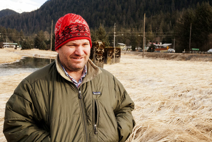
Mark Calvert was one of the first to ask one of our most frequently asked questions: What are those blocks along Vanderbilt Hill Road? We took a walk around the wetlands.
“It’s a nice cold, clear day out here — sun kind of shining through, but shining through enough,” Calvert said. “We’re in the wetlands, right at the turn off, off of Egan right by the Pioneer Home. … The creek coming out and all these concrete pilings, and traffic going by.”
The blocks stand taller than a person. With a friend, you might be able to wrap your arms around the skinnier ones.
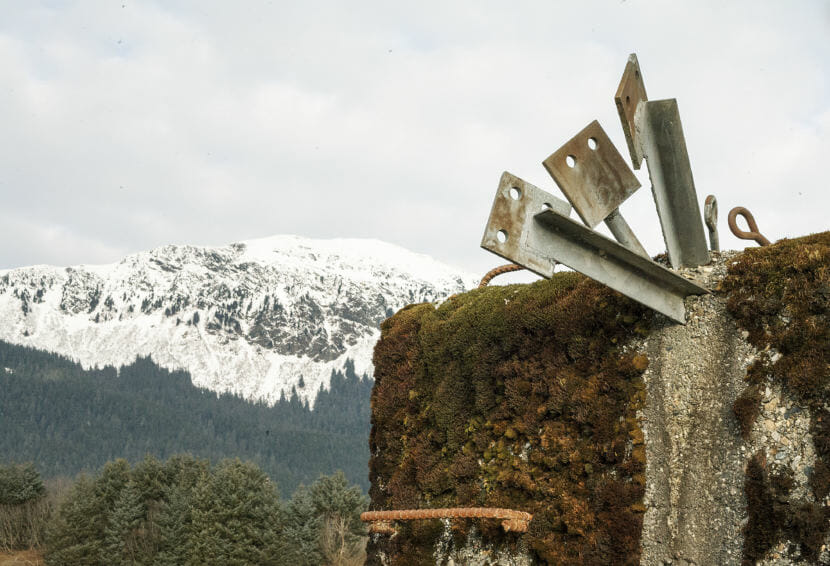
Moss has grown over the tops and sides. They’ve been there for decades. Some blocks sport rebar handles to climb up. On one, three pieces of rebar poke out the top. Perhaps they had anchored something larger?
“They’re in some type of pattern out here and I have zero idea why,” Calvert said. “So trying to figure out what the pattern is and why they’re here instead of somewhere else.”
A blog about Alaska’s Cold War-era early warning radar system led me to a military connection.
In 1992, the U.S. Army put together an inventory of debris at the site. Army documents note a 28-by-73-foot building, a 10-by-17-foot building — and 40 concrete antenna footings — our blocks!
A cartographer for the city and borough of Juneau found an aerial photo from 1962 showing the site.
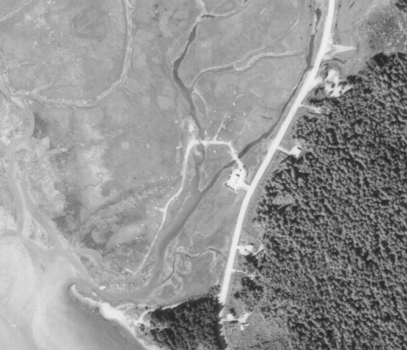
The antennas are already gone. But the footprints of the blocks are clear, including some smaller ones that have long been removed.
It’s another piece of the puzzle, from a very specific point in time and perspective.
The U.S. Army Corps of Engineers had more. The Corps documented that the Army originally obtained the site by special use permit from the Department of Interior in July 1954.
Richard Ragle is a project manager in the corps’ Alaska district. He works in a program that focuses on cleaning up formerly used Department of Defense sites.
“Most of these sites were used briefly by DOD and then turned over to other federal or private entities,” Ragle said. “This is one of the early projects that the Alaska district worked on.”
Ragle said that in 1985 the Corps hired a contractor to perform a site assessment, which included digging into some historical records about the site.
A 1986 report prepared for the Army identified the site as the Juneau Alaska Communication System Five Mile Station. That report includes a brief military history that says it was used as a “Juneau-Kenai VHF scatter circuit project and storage site.”
That’s a way to send radio signals farther without line of sight. By bouncing signals off a layer of the atmosphere, it could theoretically bounce to Kenai.
Corps documents show the U.S. Coast Guard and Bureau of Land Management took possession in 1959.
This is where the Corps’ paper trail went cold.
Former Juneau resident Kathleen “Teeney” Metcalfe was born in the mid-1950s and remembers asking her dad about the blocks. (Metcalfe moved to Anchorage about 25 years ago, but still has family in town.)
“He said that they were the bases for communication towers,” she said. “I don’t remember towers being on them, even when I was a kid, I just remember the concrete blocks.”
In the mid-1970s, Metcalfe worked as a janitor soon after graduating from high school. She remembers cleaning a telecommunications building in that area.
“It was a little tiny building, and it was somewhere near where the pioneer home is now. For whatever reason, in my mind the Coast Guard ran it,” Metcalfe said. “I remember that when you went inside there was just a bunch of radios, but that were built into the walls.”
Metcalfe says there was also a telephone operator’s headset and a switchboard.
That fits with the 1986 Corps report, Ragle said.
“The Coast Guard was using the buildings on the site and had no concerns about anything, and if I really remember correctly the state wasn’t interested in the former antenna anchors being cleaned up that were in the wetland.”
Army documents say removing the footings would be more harmful than letting them stay.
“You’d have to take a fairly big excavator into the wetlands, which would be fairly destructive,” Ragle said.
Today, online property records show Alaska Department of Natural Resources owns the property on the north side of Vanderbilt Hill Road, about 26 acres. U.S. Coast Guard owns about 5 acres on the other side.
The blocks are still there to this day. But that doesn’t keep people, like Mark Calvert, from guessing what they are.
“You never know in this town why somebody does something,” Calvert said. “You see the aftermath of a lot of crazy ideas around town sometimes.”
